
Dongaon topographic map
Interactive map
Click on the map to display elevation.
About this map
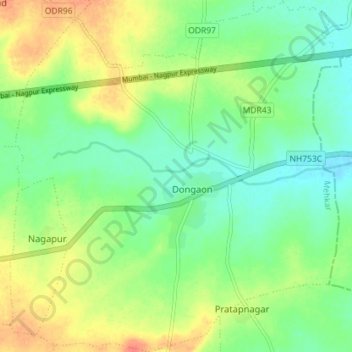
Name: Dongaon topographic map, elevation, terrain.
Location: Dongaon, Mehkar, Buldhana, Maharashtra, Inde (20.15285 76.68477 20.21977 76.75105)
Average elevation: 540 m
Minimum elevation: 521 m
Maximum elevation: 568 m