
Make a donation
Gear up for your next adventure:
As an Amazon Associate, this site earns from qualifying purchases at no extra cost to you.
Primera topographic map
Click on the map to display elevation.
Make a donation
Gear up for your next adventure:
As an Amazon Associate, this site earns from qualifying purchases at no extra cost to you.
About this map
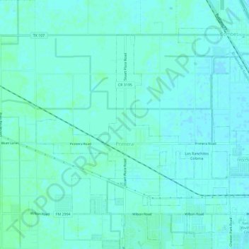
Name: Primera topographic map, elevation, terrain.
Location: Primera, Cameron County, Texas, United States (26.21134 -97.77850 26.24847 -97.72103)
Average elevation: 15 m
Minimum elevation: 12 m
Maximum elevation: 19 m
Make a donation
Gear up for your next adventure:
As an Amazon Associate, this site earns from qualifying purchases at no extra cost to you.
Other topographic maps
Click on a map to view its topography, its elevation and its terrain.
Boca Chica and Medford Colonia
United States > Texas > Cameron County > Reid Hope King > Boca Chica and Medford Colonia
Average elevation: 8 m
Windsong Village Colonia
United States > Texas > Cameron County > La Feria > Windsong Village Colonia
Average elevation: 19 m
Make a donation
Gear up for your next adventure:
As an Amazon Associate, this site earns from qualifying purchases at no extra cost to you.