Karnaprayag topographic map
Click on the map to display elevation.
Karnaprayag
Karnaprayag is located at 30°16′N 79°15′E / 30.27°N 79.25°E / 30.27; 79.25. It has an average elevation of 860 metres (2,820 feet). The confluence of the Pindar River, which arises from the icy Pindari glacier and the Alaknanda, occurs at Karnaprayag. Nanda Devi, towering above at 7,816 m (25,634 ft.), and surrounded by an array of glittering peaks, Trisul, Drona Giri, Nanda Ghunti, Mrigathuni, and Maiktoli.
About this map
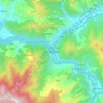
Name: Karnaprayag topographic map, elevation, terrain.
Location: Karnaprayag, Chamoli district, Uttarakhand, 246444, India (30.21965 79.17707 30.29965 79.25707)
Average elevation: 1,273 m
Minimum elevation: 714 m
Maximum elevation: 2,536 m
Other topographic maps
Click on a map to view its topography, its elevation and its terrain.