

Beau Soleil topographic map
Click on the map to display elevation.
About this map
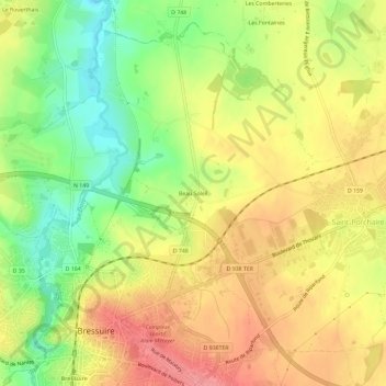
Name: Beau Soleil topographic map, elevation, terrain.
Average elevation: 167 m
Minimum elevation: 119 m
Maximum elevation: 208 m
Other topographic maps
Click on a map to view its topography, its elevation and its terrain.


Beaulieu-sous-Bressuire
France > Nouvelle-Aquitaine > Deux-Sèvres > Bressuire
Average elevation: 170 m

Noirterre
France > Nouvelle-Aquitaine > Deux-Sèvres > Bressuire
Le relief y est légèrement vallonné. Noirterre se trouve dans la zone de transition entre le bocage bressuirais et la plaine du Thouarsais. L'altitude varie entre 117 m, au point le plus bas situé à Saint-François, et 187 m au point le plus haut situé à la Haute Folie. Le paysage est caractéristique…
Average elevation: 162 m