Geolocate

Arambol topographic map

Click on the map to display elevation.

About this map

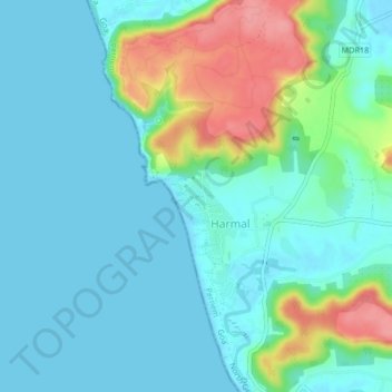
Name: Arambol topographic map, elevation, terrain.

Location: Arambol, Pernem, North Goa, Goa, 403524, India (15.67097 73.68364 15.71097 73.72364)

Average elevation: 22 m

Minimum elevation: -1 m

Maximum elevation: 91 m

Other topographic maps

Click on a map to view its topography, its elevation and its terrain.

Morjim Beach

India > Goa > Pernem

Average elevation: 3 m

Arambol Sweet Water Lake

India > Goa > Pernem > Arambol

Average elevation: 25 m

Gear up for your next adventure:

🧴Insect Repellent - Protect yourself from bugs during outdoor adventures
🛶Canoe Life Vest - Safety vest for water sports
🔋Lithium AA Batteries - Long-lasting power that performs in extreme cold
🧥Softshell Hiking Jacket - The perfect balance of wind protection and breathability
🔦LED Flashlight - Powerful and long-lasting flashlight for camping and emergencies

As an Amazon Associate, this site earns from qualifying purchases at no extra cost to you.