
Koi topographic map
Interactive map
Click on the map to display elevation.
About this map
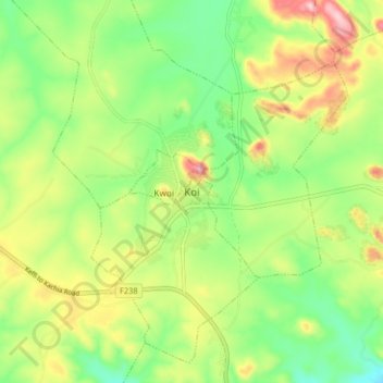
Name: Koi topographic map, elevation, terrain.
Location: Koi, Sabchem, Jaba, Kaduna State, Nigeria (9.41362 7.97057 9.49362 8.05057)
Average elevation: 769 m
Minimum elevation: 677 m
Maximum elevation: 904 m