
Thank you for supporting this site ❤️
Make a donation
Make a donation
Gear up for your next adventure:
As an Amazon Associate, this site earns from qualifying purchases at no extra cost to you.
Lebenstedt topographic map
Click on the map to display elevation.
Thank you for supporting this site ❤️
Make a donation
Make a donation
Gear up for your next adventure:
As an Amazon Associate, this site earns from qualifying purchases at no extra cost to you.
About this map
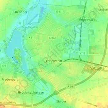
Name: Lebenstedt topographic map, elevation, terrain.
Location: Lebenstedt, Ortschaft Nord, Salzgitter, Lower Saxony, Germany (52.13560 10.28177 52.17664 10.35341)
Average elevation: 92 m
Minimum elevation: 78 m
Maximum elevation: 110 m
Thank you for supporting this site ❤️
Make a donation
Make a donation
Gear up for your next adventure:
As an Amazon Associate, this site earns from qualifying purchases at no extra cost to you.