Geolocate

Prescott topographic map

Click on the map to display elevation.

Prescott

Prescott is in the Bradshaw Mountains of central Arizona, at an elevation of 5,400 feet (1,600 m). The city has a Mediterranean climate (Köppen Csa); however, unlike most other locations in this climate class, there is a pronounced summer wet season due to the North American Monsoon.

About this map

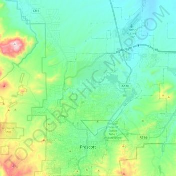
Name: Prescott topographic map, elevation, terrain.

Location: Prescott, Yavapai County, Arizona, United States of America (34.51254 -112.52996 34.67994 -112.37610)

Average elevation: 1,674 m

Minimum elevation: 1,486 m

Maximum elevation: 2,302 m

Gear up for your next adventure:

💡LED Headlamp - Hands-free illumination for night hiking and camping
🥾Trail Hiking Shoes - Durable shoes designed for rugged trails
🧣Merino Neck Gaiter - Protects against wind, sun, and cold at high altitudes
🧦Crew Hiking Socks - Comfortable socks for long-distance hikes
🥾Trail Hiking Socks - Comfortable socks to prevent blisters and fatigue

As an Amazon Associate, this site earns from qualifying purchases at no extra cost to you.