Geolocate

Selma topographic map

Click on the map to display elevation.

About this map

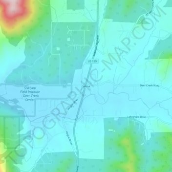
Name: Selma topographic map, elevation, terrain.

Location: Selma, Josephine County, Oregon, 97538, United States (42.25900 -123.63590 42.29900 -123.59590)

Average elevation: 438 m

Minimum elevation: 388 m

Maximum elevation: 754 m

Other topographic maps

Click on a map to view its topography, its elevation and its terrain.

Grants Pass

United States > Oregon > Josephine County

Average elevation: 377 m

Gear up for your next adventure:

🧤Insulated Winter Gloves - Heavy-duty protection for sub-zero Canadian adventures
👟Sport Hiking Sandals - Breathable footwear for water crossings and camp rest
🥾Hiking Shorts - Breathable shorts suitable for summer hikes
🛶Canoe Life Vest - Safety vest for water sports
🛏️Camping Sleeping Mat - Comfortable mats for sleeping outdoors

As an Amazon Associate, this site earns from qualifying purchases at no extra cost to you.