Geolocate

Sucaraylla topographic map

Click on the map to display elevation.

About this map

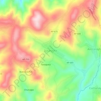
Name: Sucaraylla topographic map, elevation, terrain.

Location: Sucaraylla, Andahuaylas, Apurímac, Perú (-13.75305 -73.41473 -13.71305 -73.37473)

Average elevation: 3,631 m

Minimum elevation: 3,454 m

Maximum elevation: 3,796 m

Other topographic maps

Click on a map to view its topography, its elevation and its terrain.

Andahuaylas

Perú > Apurímac > Andahuaylas

Average elevation: 3,818 m

Gear up for your next adventure:

🚲Handlebar Phone Mount - View topographic-map.com live while cycling
🔋Solar Power Bank - Keep your GPS and devices charged during long outdoor trips
🧥Softshell Jacket - Windproof and breathable jacket for hiking
Camping Groundsheet - Protect your tent from moisture and dirt
🧭GPS Outdoor Watch - Smart watch for navigation and fitness tracking in nature

As an Amazon Associate, this site earns from qualifying purchases at no extra cost to you.