Geolocate

Bademli Mahallesi topographic map

Click on the map to display elevation.

About this map

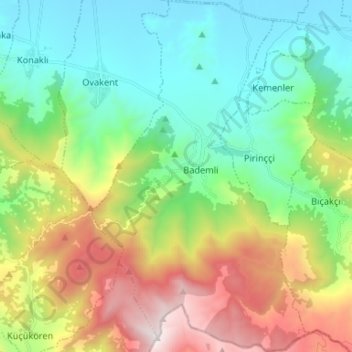
Name: Bademli Mahallesi topographic map, elevation, terrain.

Location: Bademli Mahallesi, Ödemiş, Izmir, Aegean Region, Turkey (38.02500 28.01726 38.12883 28.09960)

Average elevation: 686 m

Minimum elevation: 125 m

Maximum elevation: 1,829 m

Gear up for your next adventure:

🧴Sunscreen SPF - Broad-spectrum sunscreen for outdoor activities
🛏️Camping Sleeping Mat - Comfortable mats for sleeping outdoors
🏕️Camping Hammock - Integrated protection for sleeping between trees
🧤Rechargeable Heated Gloves - Extreme warmth for Canadian winter expeditions
🔪Outdoor Multitool - Versatile tool for repairs and food prep in the wild

As an Amazon Associate, this site earns from qualifying purchases at no extra cost to you.