
Thank you for supporting this site ❤️
Make a donation
Make a donation
Gear up for your next adventure:
As an Amazon Associate, this site earns from qualifying purchases at no extra cost to you.
Leza topographic map
Click on the map to display elevation.
Thank you for supporting this site ❤️
Make a donation
Make a donation
Gear up for your next adventure:
As an Amazon Associate, this site earns from qualifying purchases at no extra cost to you.
About this map
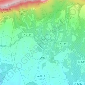
Name: Leza topographic map, elevation, terrain.
Location: Leza, Rioja Alavaise, Alava, Pays basque autonome, Espagne (42.55102 -2.65523 42.59601 -2.61630)
Average elevation: 659 m
Minimum elevation: 494 m
Maximum elevation: 1,263 m
Thank you for supporting this site ❤️
Make a donation
Make a donation
Gear up for your next adventure:
As an Amazon Associate, this site earns from qualifying purchases at no extra cost to you.