
Athy topographic map
Interactive map
Click on the map to display elevation.
About this map
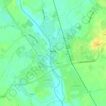
Name: Athy topographic map, elevation, terrain.
Location: Athy, Comté de Kildare, Leinster, Irlande (52.97658 -7.00297 53.00723 -6.95904)
Average elevation: 61 m
Minimum elevation: 51 m
Maximum elevation: 76 m
Other topographic maps
Click on a map to view its topography, its elevation and its terrain.
Ballyshannon
Ballyshannon, Ballyshannon ED, The Municipal District of Athy, Comté de Kildare, Leinster, Irlande
Average elevation: 105 m
Collin
Collin, Carrigeen ED, The Municipal District of Athy, Comté de Kildare, Leinster, Irlande
Average elevation: 169 m
Reeves
Reeves, Donaghcumper ED, The Municipal District of Celbridge — Leixlip, Comté de Kildare, Leinster, Irlande
Average elevation: 61 m
Rahin
Rahin, Carrick ED, The Municipal District of Clane — Maynooth, Comté de Kildare, Leinster, Irlande
Average elevation: 74 m
Athy
Athy, Athy Urban East ED, The Municipal District of Athy, Comté de Kildare, Leinster, R14 XD30, Irlande
Average elevation: 61 m