Geolocate

Stonegate topographic map

Click on the map to display elevation.

About this map

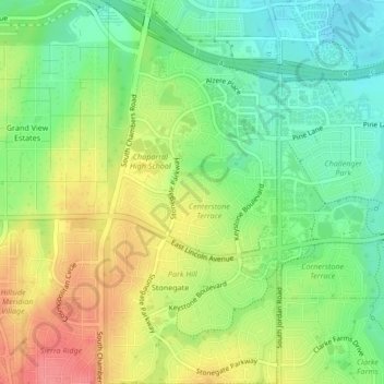
Name: Stonegate topographic map, elevation, terrain.

Location: Stonegate, Parker, Douglas County, Colorado, United States (39.52234 -104.81243 39.55478 -104.79350)

Average elevation: 1,781 m

Minimum elevation: 1,746 m

Maximum elevation: 1,824 m

Gear up for your next adventure:

🥾Waterproof Hiking Boots - Boots keeping your feet dry in wet conditions
🧤Thermal Hiking Gloves - Grip-enhanced gloves for cold-weather altitude trekking
Lightweight Backpacking Tent - Compact tent for efficient hiking trips
🦶Anti-Blister Balm - Prevents friction and hotspots during long ascents
🏃Hydration Running Vest - Carry water and maps close to your body for speed

As an Amazon Associate, this site earns from qualifying purchases at no extra cost to you.