
Thank you for supporting this site ❤️
Make a donation
Make a donation
Gear up for your next adventure:
As an Amazon Associate, this site earns from qualifying purchases at no extra cost to you.
Yeldeğirmeni topographic map
Click on the map to display elevation.
Thank you for supporting this site ❤️
Make a donation
Make a donation
Gear up for your next adventure:
As an Amazon Associate, this site earns from qualifying purchases at no extra cost to you.
About this map
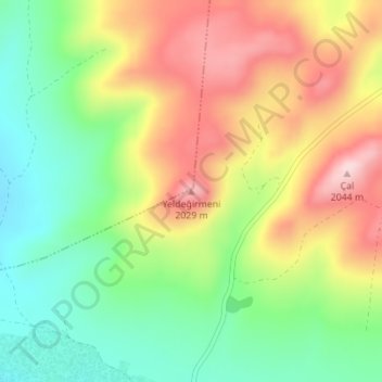
Name: Yeldeğirmeni topographic map, elevation, terrain.
Location: Yeldeğirmeni, Pınarbaşı, Central Anatolia Region, Turkey (38.90243 36.82522 38.90253 36.82532)
Average elevation: 1,905 m
Minimum elevation: 1,782 m
Maximum elevation: 2,054 m
Thank you for supporting this site ❤️
Make a donation
Make a donation
Gear up for your next adventure:
As an Amazon Associate, this site earns from qualifying purchases at no extra cost to you.