Geolocate

Pietranico topographic map

Click on the map to display elevation.

About this map

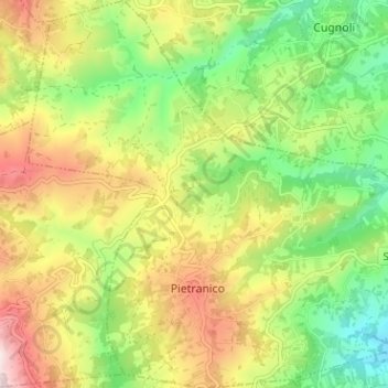
Name: Pietranico topographic map, elevation, terrain.

Location: Pietranico, Pescara, Abruzzo, Italy (42.26426 13.88312 42.31124 13.94627)

Average elevation: 396 m

Minimum elevation: 150 m

Maximum elevation: 717 m

Gear up for your next adventure:

🛶Canoe Life Vest - Safety vest for water sports
🛶Waterproof Dry Bags - Keep electronics and clothes dry during river crossings
🧭Orienteering Kit - Tools for map reading and navigation in the wild
🧰Emergency Multi-Tool - Compact multi-tool for outdoor survival
🧥Insulated Jacket - Keep warm in cold outdoor conditions

As an Amazon Associate, this site earns from qualifying purchases at no extra cost to you.