Geolocate

Cappelletta topographic map

Click on the map to display elevation.

About this map

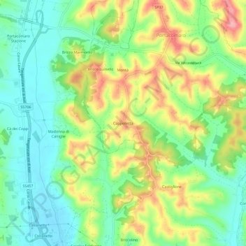
Name: Cappelletta topographic map, elevation, terrain.

Location: Cappelletta, Portacomaro, Asti, Piemonte, 14037, Italia (44.92330 8.22708 44.96330 8.26708)

Average elevation: 169 m

Minimum elevation: 119 m

Maximum elevation: 245 m

Gear up for your next adventure:

Camping Coffee Maker - Brew fresh coffee anywhere on the topographic map
🏕️Camping Hammock - Integrated protection for sleeping between trees
🔦LED Headlamp - Hands-free lighting for early morning starts or late finishes
🥾Trail Hiking Shoes - Durable shoes designed for rugged trails
🧴Insect Repellent - Protect yourself from bugs during outdoor adventures

As an Amazon Associate, this site earns from qualifying purchases at no extra cost to you.