Geolocate

Jonki topographic map

Click on the map to display elevation.

About this map

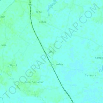
Name: Jonki topographic map, elevation, terrain.

Location: Jonki, Balrampur, Katihar, Bihar, India (25.76134 87.83226 25.80134 87.87226)

Average elevation: 35 m

Minimum elevation: 32 m

Maximum elevation: 39 m

Gear up for your next adventure:

🥾Trekking Poles - Adjustable trekking poles to reduce knee stress and improve stability
🧼Biodegradable Camp Soap - Environmentally friendly cleaning for gear and body
💡LED Headlamp - Hands-free illumination for night hiking and camping
🎒Hiking Daypack - Lightweight and durable backpacks for day trips and excursions
🧤Insulated Winter Gloves - Heavy-duty protection for sub-zero Canadian adventures

As an Amazon Associate, this site earns from qualifying purchases at no extra cost to you.