
Iowa City topographic map
Click on the map to display elevation.
Iowa City
The elevation at the Iowa City Municipal Airport is 668 ft (203.6 m) above sea level.
About this map
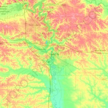
Name: Iowa City topographic map, elevation, terrain.
Location: Iowa City, Johnson County, Iowa, 52240-5544, United States (41.50126 -91.68991 41.82126 -91.36991)
Average elevation: 225 m
Minimum elevation: 182 m
Maximum elevation: 269 m