Geolocate

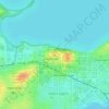
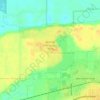
Fitchburg topographic map

Click on the map to display elevation.

About this map
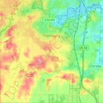
Name: Fitchburg topographic map, elevation, terrain.

Location: Fitchburg, Dane County, Wisconsin, United States (42.94294 -89.48696 43.03940 -89.36483)

Average elevation: 299 m

Minimum elevation: 258 m

Maximum elevation: 365 m

Other topographic maps

Click on a map to view its topography, its elevation and its terrain.

Waunakee Marsh

United States > Wisconsin > Dane County > Waunakee

Average elevation: 292 m

Buss's Corners

United States > Wisconsin > Dane County

Average elevation: 289 m

Burke

United States > Wisconsin > Dane County > Madison

Average elevation: 292 m

Table Bluff

United States > Wisconsin > Dane County

Average elevation: 306 m

Frederick's Hill

United States > Wisconsin > Dane County

Average elevation: 279 m

Stoughton

United States > Wisconsin > Dane County > Stoughton

Average elevation: 270 m

Bowens Addition

United States > Wisconsin > Dane County > Madison

Average elevation: 266 m

East Bristol

United States > Wisconsin > Dane County

Average elevation: 285 m

Marxville

United States > Wisconsin > Dane County > Town of Berry

Average elevation: 300 m

Gear up for your next adventure:

🧥Waterproof Hiking Jacket - Protect yourself from rain and wind while hiking
🔋Emergency Crank Radio - Weather alerts and power without needing batteries
🔋Solar Power Bank - Keep your GPS and devices charged during long outdoor trips
🧣Merino Neck Gaiter - Protects against wind, sun, and cold at high altitudes
🔦LED Flashlight - Powerful and long-lasting flashlight for camping and emergencies

As an Amazon Associate, this site earns from qualifying purchases at no extra cost to you.