Geolocate

Keda Municipality topographic map

Click on the map to display elevation.

About this map

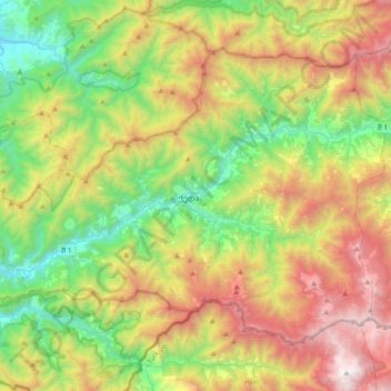
Name: Keda Municipality topographic map, elevation, terrain.

Location: Keda Municipality, Autonomous Republic of Adjara, Georgia (41.49395 41.75466 41.70373 42.12615)

Average elevation: 1,024 m

Minimum elevation: 30 m

Maximum elevation: 2,615 m

Other topographic maps

Click on a map to view its topography, its elevation and its terrain.

Gear up for your next adventure:

🧭GPS Tracker - Track your location in remote areas safely
🧰Emergency Multi-Tool - Compact multi-tool for outdoor survival
🛶Kayak Dry Bag - Waterproof storage for kayaking adventures
🥾Mountain Hiking Boots - High-traction boots for rocky terrain
🧥Ultralight Puffy Jacket - Maximum warmth that packs down to the size of an orange

As an Amazon Associate, this site earns from qualifying purchases at no extra cost to you.