Geolocate

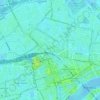
Rotterdam topographic map

Click on the map to display elevation.

About this map
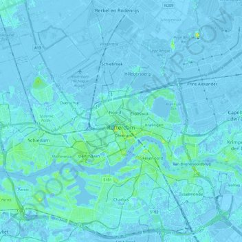
Name: Rotterdam topographic map, elevation, terrain.

Location: Rotterdam, South Holland, Netherlands (51.86167 4.37931 51.99427 4.60181)

Average elevation: 0 m

Minimum elevation: -8 m

Maximum elevation: 21 m

Other topographic maps

Click on a map to view its topography, its elevation and its terrain.

Tweede Tol

Netherlands > South Holland > Dordrecht

Average elevation: 0 m

Gooland

Netherlands > South Holland > Nootdorp

Average elevation: -2 m

Langeraar

Netherlands > South Holland

Average elevation: -3 m

Waalhaven

Netherlands > South Holland > Rotterdam

Average elevation: 3 m

Meijendel

Netherlands > South Holland > Wassenaar

Average elevation: 6 m

Meije

Netherlands > South Holland > Nieuwkoop

Average elevation: -2 m

Ankerpark

Netherlands > South Holland > Leiden

Average elevation: 3 m

Botlek

Netherlands > South Holland

Average elevation: 3 m

Weerestein

Netherlands > South Holland > Hillegom

Average elevation: 0 m

Weerestein

Netherlands > South Holland > Hillegom

Average elevation: 0 m

Coepelduynen

Netherlands > South Holland > Katwijk

Average elevation: 4 m

Middelsluis

Netherlands > South Holland > Numansdorp

Average elevation: 0 m

Broekhuizen

Netherlands > South Holland > Gouda

Average elevation: -1 m

Het Park

Netherlands > South Holland > Rotterdam

Average elevation: 4 m

Gear up for your next adventure:

💧Collapsible Water Bottle - Space-saving water bottle for outdoor activities
🐕Hiking Dog Pack - Let your canine companion carry their own water and food
🥾Durable Hiking Shoes - Long-lasting shoes for frequent hiking
🧦Hiking Socks - Moisture-wicking and comfortable socks for long hikes
💧Hydration Bladder - Hands-free hydration solution for long treks

As an Amazon Associate, this site earns from qualifying purchases at no extra cost to you.