Geolocate

Ferndale topographic map

Click on the map to display elevation.

About this map

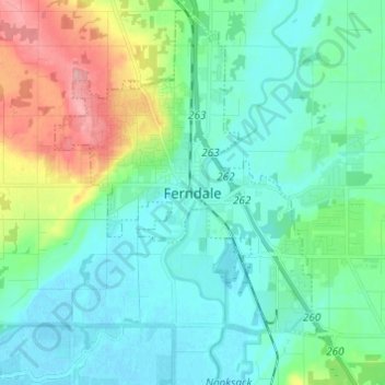
Name: Ferndale topographic map, elevation, terrain.

Location: Ferndale, Whatcom County, Washington, 98248, United States (48.80667 -122.62972 48.88667 -122.54972)

Average elevation: 29 m

Minimum elevation: -2 m

Maximum elevation: 120 m

Gear up for your next adventure:

🧭GPS Outdoor Watch - Smart watch for navigation and fitness tracking in nature
🔥Camping Stove - Portable stoves to cook outdoors with ease
📷Outdoor Action Camera - Capture high-elevation views and rugged adventures
🛁Quick-Dry Microfiber Towel - Space-saving towel that dries rapidly on the move
🔋Emergency Crank Radio - Weather alerts and power without needing batteries

As an Amazon Associate, this site earns from qualifying purchases at no extra cost to you.