Geolocate

Lumut topographic map

Click on the map to display elevation.

About this map

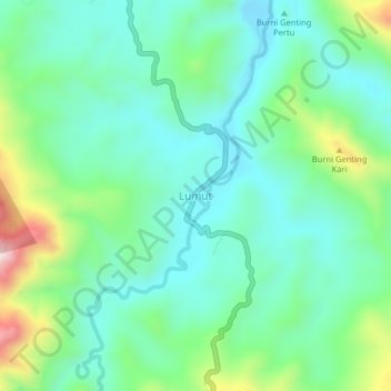
Name: Lumut topographic map, elevation, terrain.

Location: Lumut, Linge, Aceh Tengah, Aceh, Sumatra, Indonesia (4.31389 97.12041 4.35389 97.16041)

Average elevation: 561 m

Minimum elevation: 437 m

Maximum elevation: 909 m

Gear up for your next adventure:

🦶Hiking Shoe Insoles - Added support for high arches and long days on feet
🧤Insulated Winter Gloves - Heavy-duty protection for sub-zero Canadian adventures
Camping Essentials - All-in-one gear for a comfortable camping trip
🚲MTB Frame Bag - Carry tools and maps directly on your bicycle frame
🧢Outdoor Cap - Protective cap for sun and rain during hikes

As an Amazon Associate, this site earns from qualifying purchases at no extra cost to you.