Geolocate

Dello topographic map

Click on the map to display elevation.

About this map

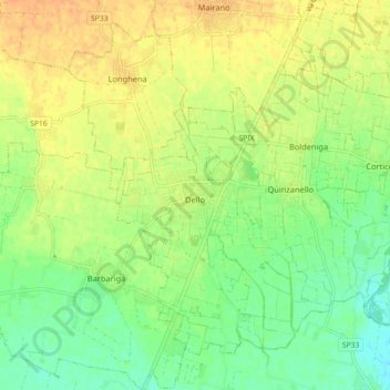
Name: Dello topographic map, elevation, terrain.

Location: Dello, Brescia, Lombardy, Italy (45.39307 10.05695 45.44458 10.14657)

Average elevation: 85 m

Minimum elevation: 68 m

Maximum elevation: 100 m

Gear up for your next adventure:

🛰️Satellite Messenger - Emergency communication for areas with no cell service
🔦LED Headtorch - Bright and durable light for night activities
🥾Waterproof Hiking Boots - Boots keeping your feet dry in wet conditions
🛁Quick-Dry Microfiber Towel - Space-saving towel that dries rapidly on the move
🥾Trail Hiking Boots - Supportive boots for rough trails

As an Amazon Associate, this site earns from qualifying purchases at no extra cost to you.