
Make a donation
Gear up for your next adventure:
As an Amazon Associate, this site earns from qualifying purchases at no extra cost to you.
Okkevoorde topographic map
Click on the map to display elevation.
Make a donation
Gear up for your next adventure:
As an Amazon Associate, this site earns from qualifying purchases at no extra cost to you.
About this map
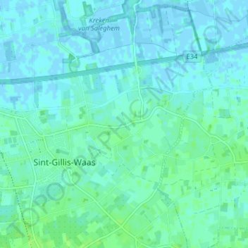
Name: Okkevoorde topographic map, elevation, terrain.
Average elevation: 3 m
Minimum elevation: -3 m
Maximum elevation: 10 m
Make a donation
Gear up for your next adventure:
As an Amazon Associate, this site earns from qualifying purchases at no extra cost to you.
Other topographic maps
Click on a map to view its topography, its elevation and its terrain.
Meerdonk
België > Oost-Vlaanderen > Sint-Niklaas > Sint-Gillis-Waas
Meerdonk ligt in het gebied van de Wase Scheldepolders. De hoogte bedraagt ongeveer 2,5 meter.
Average elevation: 1 m
De Klinge
België > Oost-Vlaanderen > Sint-Niklaas > Sint-Gillis-Waas
De Klinge ligt aan de Belgisch-Nederlandse grens. Men vindt er de bossen van Zandig Vlaanderen, zoals het Stropersbos, en ook Scheldepolders met kreken zoals het Saleghem Krekengebied. De hoogte loopt op tot 5 meter. De Klinge wordt gerekend tot het Waasland.
Average elevation: 3 m