
Tortola topographic map
Interactive map
Click on the map to display elevation.
About this map
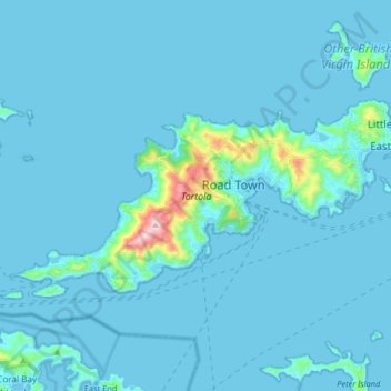
Name: Tortola topographic map, elevation, terrain.
Location: Tortola, Road Town, British Virgin Islands (18.38239 -64.71739 18.45975 -64.55329)
Average elevation: 29 m
Minimum elevation: -2 m
Maximum elevation: 512 m
Other topographic maps
Click on a map to view its topography, its elevation and its terrain.
Queen Elizabeth Park
British Virgin Islands > Road Town
Queen Elizabeth Park, Road Town, Tortola, British Virgin Islands
Average elevation: 35 m