Geolocate

Whitford topographic map

Click on the map to display elevation.

About this map

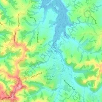
Name: Whitford topographic map, elevation, terrain.

Location: Whitford, Franklin, Auckland, 2571, New Zealand (-36.96547 174.94378 -36.92547 174.98378)

Average elevation: 46 m

Minimum elevation: 0 m

Maximum elevation: 139 m

Gear up for your next adventure:

🔋Solar Power Bank - Keep your GPS and devices charged during long outdoor trips
🔋Emergency Crank Radio - Weather alerts and power without needing batteries
🧢Hiking Sun Hat - Wide-brimmed protection for exposed mountain ridges
🧭GPS Outdoor Watch - Smart watch for navigation and fitness tracking in nature
👟Leg Gaiters - Keep debris, mud, and snow out of your boots

As an Amazon Associate, this site earns from qualifying purchases at no extra cost to you.