Geolocate

Prati topographic map

Click on the map to display elevation.

About this map

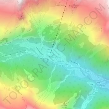
Name: Prati topographic map, elevation, terrain.

Location: Prati, Macugnaga, Verbano-Cusio-Ossola, Piedmont, 28876, Italy (45.94919 7.94711 45.98919 7.98711)

Average elevation: 1,809 m

Minimum elevation: 1,153 m

Maximum elevation: 2,772 m

Gear up for your next adventure:

🧥Waterproof Pants - Keep dry during rainy hiking conditions
🛏️Camping Sleeping Mat - Comfortable mats for sleeping outdoors
🧴Insect Repellent - Protect yourself from bugs during outdoor adventures
🔦LED Headlamp - Hands-free lighting for early morning starts or late finishes
🥾Trekking Poles - Adjustable trekking poles to reduce knee stress and improve stability

As an Amazon Associate, this site earns from qualifying purchases at no extra cost to you.