
Rockingham topographic map
Interactive map
Click on the map to display elevation.
About this map
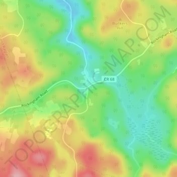
Name: Rockingham topographic map, elevation, terrain.
Average elevation: 374 m
Minimum elevation: 309 m
Maximum elevation: 451 m
Other topographic maps
Click on a map to view its topography, its elevation and its terrain.
Bobs Lake
Canada > Ontario > Brudenell, Lyndoch and Raglan
Bobs Lake, Genricks Road, Brudenell, Lyndoch and Raglan, Renfrew County, Eastern Ontario, Ontario, K0J 2E0, Canada
Average elevation: 443 m