Geolocate

Gohier topographic map

Click on the map to display elevation.

About this map

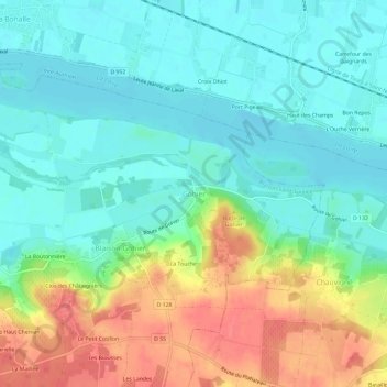
Name: Gohier topographic map, elevation, terrain.

Location: Gohier, Blaison-Saint-Sulpice, Angers, Maine-et-Loire, Pays de la Loire, France métropolitaine, 49320, France (47.38563 -0.38023 47.42563 -0.34023)

Average elevation: 38 m

Minimum elevation: 14 m

Maximum elevation: 83 m

Other topographic maps

Click on a map to view its topography, its elevation and its terrain.

Gear up for your next adventure:

🔭Compact Monocular - One-handed bird watching and trail spotting
👖Convertible Hiking Pants - Zip-off legs to adapt to changing weather conditions
🧶550 Survival Paracord - Versatile utility cord for emergency repairs and rigging
🛶Kayak Dry Bag - Waterproof storage for kayaking adventures
🪜Heavy Duty Carabiners - Multi-use clips for securing gear to your backpack

As an Amazon Associate, this site earns from qualifying purchases at no extra cost to you.