Geolocate

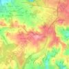
24800 topographic map

Click on the map to display elevation.

About this map

Name: 24800 topographic map, elevation, terrain.

Location: 24800, Thiviers, Nontron, Dordogne, Nouvelle-Aquitaine, France métropolitaine, France (45.33250 0.77253 45.53331 1.08851)

Average elevation: 245 m

Minimum elevation: 123 m

Maximum elevation: 381 m

Other topographic maps

Click on a map to view its topography, its elevation and its terrain.
Razac

France > Nouvelle-Aquitaine > Dordogne > Thiviers

Average elevation: 232 m

Mauchat

France > Nouvelle-Aquitaine > Dordogne > Thiviers

Average elevation: 234 m

Gear up for your next adventure:

🥾Mountaineering Boots - Supportive boots for climbing and high-altitude hiking
🧴Insect Repellent - Protect yourself from bugs during outdoor adventures
💧Hydration Bladder - Hands-free hydration solution for long treks
🔥Camping Stove - Portable stoves to cook outdoors with ease
🥾Trail Hiking Socks - Comfortable socks to prevent blisters and fatigue

As an Amazon Associate, this site earns from qualifying purchases at no extra cost to you.