Geolocate

C.P. Timon topographic map

Click on the map to display elevation.

About this map

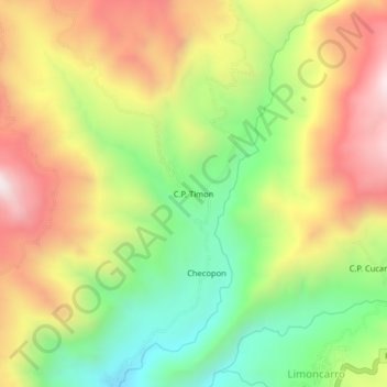
Name: C.P. Timon topographic map, elevation, terrain.

Location: C.P. Timon, Llama, Provincia de Chota, Cajamarca, Perú (-6.49228 -79.17581 -6.45228 -79.13581)

Average elevation: 1,437 m

Minimum elevation: 1,008 m

Maximum elevation: 1,908 m

Gear up for your next adventure:

💧Collapsible Water Bottle - Space-saving water bottle for outdoor activities
🧴Outdoor Sunscreen - High SPF protection for high-altitude UV exposure
🥾Trail Hiking Socks - Comfortable socks to prevent blisters and fatigue
🧤Rechargeable Heated Gloves - Extreme warmth for Canadian winter expeditions
🧭Orienteering Kit - Tools for map reading and navigation in the wild

As an Amazon Associate, this site earns from qualifying purchases at no extra cost to you.