Geolocate

Sachacoco topographic map

Click on the map to display elevation.

About this map

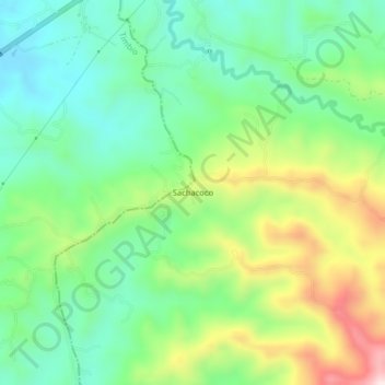
Name: Sachacoco topographic map, elevation, terrain.

Location: Sachacoco, Sotará, Centro, Cauca, RAP Pacífico, Colombia (2.35123 -76.66613 2.39123 -76.62613)

Average elevation: 1,899 m

Minimum elevation: 1,746 m

Maximum elevation: 2,194 m

Other topographic maps

Click on a map to view its topography, its elevation and its terrain.

Marqueza

Colombia > Cauca > Sotará

Average elevation: 1,771 m

Gear up for your next adventure:

🥾Lightweight Hiking Shoes - Comfortable shoes for day hikes
🚲Bike Repair Kit - Essential tools for on-trail mechanical issues
🥘Camping Cookware Set - Compact nesting pots and pans for trail cooking
🥾Lightweight Hiking Boots - Boots for comfort and mobility on long hikes
🥤Collapsible Travel Cup - Saves space and weight in your mess kit

As an Amazon Associate, this site earns from qualifying purchases at no extra cost to you.