
Zelienople topographic map
Click on the map to display elevation.
Zelienople
Zelienople is located in southwestern Butler County, situated on the south bank of Connoquenessing Creek, in an area that is rich with coal and iron ore. The elevation is 935 feet (285 m) above sea level. The borough is bordered by Jackson Township on the north, southeast, and south, and by the borough of Harmony on the northeast. The western border of Zelienople is the Beaver County line.
About this map
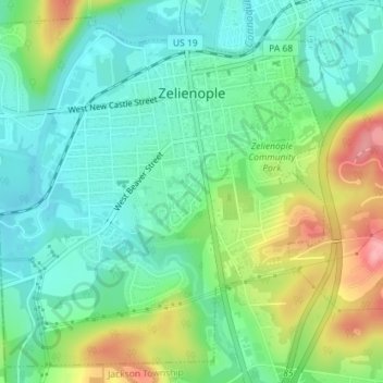
Name: Zelienople topographic map, elevation, terrain.
Location: Zelienople, Butler County, Pennsylvania, United States (40.77641 -80.15580 40.80111 -80.12480)
Average elevation: 305 m
Minimum elevation: 266 m
Maximum elevation: 386 m
Other topographic maps
Click on a map to view its topography, its elevation and its terrain.
Glade Mills
United States > Pennsylvania > Butler County > Middlesex Township
Average elevation: 359 m
Butler Farm Show Lake
United States > Pennsylvania > Butler County > Meridian
Average elevation: 392 m