Geolocate

Osgoode topographic map

Click on the map to display elevation.

About this map

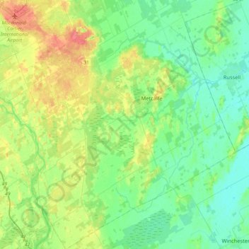
Name: Osgoode topographic map, elevation, terrain.

Location: Osgoode, Ottawa, Eastern Ontario, Ontario, Canada (45.08438 -75.67970 45.33447 -75.35318)

Average elevation: 86 m

Minimum elevation: 68 m

Maximum elevation: 125 m

Ontario trails, hiking, mountain biking, running and outdoor activities

Gear up for your next adventure:

🥾Approach Shoes - Shoes designed for climbing approaches and rugged trails
🕶️Polarized Sunglasses - Reduces glare from snow and water at high elevations
🚲Handlebar Phone Mount - View topographic-map.com live while cycling
👟Sport Hiking Sandals - Breathable footwear for water crossings and camp rest
🧭GPS Tracker - Track your location in remote areas safely

As an Amazon Associate, this site earns from qualifying purchases at no extra cost to you.