
Make a donation
Gear up for your next adventure:
As an Amazon Associate, this site earns from qualifying purchases at no extra cost to you.
Willow Street topographic map
Click on the map to display elevation.
Make a donation
Gear up for your next adventure:
As an Amazon Associate, this site earns from qualifying purchases at no extra cost to you.
Willow Street
Pennsylvania Route 272 (Willow Street Pike) is the main highway through the community. It is split into two one-way streets, with the northbound lanes following the original main street through the town, and the southbound lanes running four blocks to the west. PA 272 leads north 4 miles (6 km) to the center of Lancaster, the county seat, and south 15 miles (24 km) to Wakefield. U.S. Route 222 joins PA 272 in the north part of the CDP (shown as "Mylin Corners" on USGS topographic maps) and leads north into Lancaster but southeast 10 miles (16 km) to Quarryville.
Make a donation
Gear up for your next adventure:
As an Amazon Associate, this site earns from qualifying purchases at no extra cost to you.
About this map
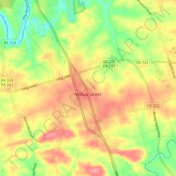
Name: Willow Street topographic map, elevation, terrain.
Location: Willow Street, Lancaster County, Pennsylvania, United States (39.95160 -76.29495 40.01138 -76.24527)
Average elevation: 120 m
Minimum elevation: 68 m
Maximum elevation: 165 m
Make a donation
Gear up for your next adventure:
As an Amazon Associate, this site earns from qualifying purchases at no extra cost to you.