Geolocate

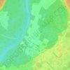
Lac Campan topographic map

Click on the map to display elevation.

About this map

Name: Lac Campan topographic map, elevation, terrain.

Location: Lac Campan, Saint-Gabriel-de-Valcartier, La Jacques-Cartier, Capitale-Nationale, Québec, Canada (47.12505 -71.72070 47.12604 -71.71973)

Average elevation: 675 m

Minimum elevation: 535 m

Maximum elevation: 809 m

Other topographic maps

Click on a map to view its topography, its elevation and its terrain.
Gear up for your next adventure:

🥘Camping Cookware Set - Compact nesting pots and pans for trail cooking
🏃Hydration Running Vest - Carry water and maps close to your body for speed
📷Outdoor Action Camera - Capture high-elevation views and rugged adventures
🥾Hiking Leggings - Comfortable leggings for outdoor activities
🥾Light Trekking Boots - Supportive boots for multi-day treks

As an Amazon Associate, this site earns from qualifying purchases at no extra cost to you.