Geolocate

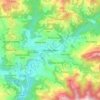
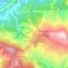
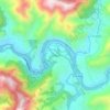
Gajuri topographic map

Click on the map to display elevation.

About this map

Name: Gajuri topographic map, elevation, terrain.

Location: Gajuri, Dhading, Bagamati Province, 00977, Nepal (27.68328 84.82202 27.81685 84.98903)

Average elevation: 1,068 m

Minimum elevation: 338 m

Maximum elevation: 2,318 m

Other topographic maps

Click on a map to view its topography, its elevation and its terrain.

Nilakantha

Nepal > Bagamati Province > Dhading

Average elevation: 873 m

Naubise

Nepal > Bagamati Province > Dhading

Average elevation: 1,320 m

Dhading Besi

Nepal > Bagamati Province > Dhading

It is at 27°54'45.9"N 84°53'46.2"E at an altitude of 612 metres.

Average elevation: 873 m
Tipling

Nepal > Bagamati Province > Dhading

Average elevation: 2,169 m

Jyamire Bhanjyang

Nepal > Bagamati Province > Dhading

Average elevation: 962 m

Handikhola Gaun

Nepal > Bagamati Province > Dhading

Average elevation: 1,140 m

Charunge

Nepal > Bagamati Province > Dhading

Average elevation: 1,050 m

Dhunibesi

Nepal > Bagamati Province > Dhading

Average elevation: 1,318 m

Purano Malekhu

Nepal > Bagamati Province > Dhading

Average elevation: 523 m

Vhaduwar Gau

Nepal > Bagamati Province > Dhading

Average elevation: 790 m

Malekhu

Nepal > Bagamati Province > Dhading

Average elevation: 550 m

Kharka

Nepal > Bagamati Province > Dhading > Ramkot Kumal Gaun

Average elevation: 723 m

Shingatar

Nepal > Bagamati Province > Dhading

Average elevation: 684 m

Baireni

Nepal > Bagamati Province > Dhading > Galchhi

Average elevation: 599 m

Gear up for your next adventure:

🚑Survival Whistle - Signal for help across long distances in mountains
🧴Sunscreen SPF - Broad-spectrum sunscreen for outdoor activities
🧤Rechargeable Heated Gloves - Extreme warmth for Canadian winter expeditions
🧣Merino Neck Gaiter - Protects against wind, sun, and cold at high altitudes
🧥Softshell Jacket - Windproof and breathable jacket for hiking

As an Amazon Associate, this site earns from qualifying purchases at no extra cost to you.