Geolocate

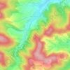
Eltmannshausen topographic map

Click on the map to display elevation.

About this map

Name: Eltmannshausen topographic map, elevation, terrain.

Location: Eltmannshausen, Eschwege, Werra-Meißner-Kreis, Hesse, Germany (51.17702 9.95088 51.19802 9.99591)

Average elevation: 196 m

Minimum elevation: 157 m

Maximum elevation: 258 m

Other topographic maps

Click on a map to view its topography, its elevation and its terrain.

Alpstein

Germany > Hesse > Werra-Meißner-Kreis > Kirchhosbach

Average elevation: 320 m

Konstein

Germany > Hesse > Werra-Meißner-Kreis > Wanfried

Average elevation: 366 m

Gear up for your next adventure:

🧼Travel Hand Sanitizer - Keep hands clean when water is scarce
🥾Approach Boots - Comfortable boots for hiking and climbing approaches
🥾Trail Hiking Socks - Comfortable socks to prevent blisters and fatigue
🧥Softshell Hiking Jacket - The perfect balance of wind protection and breathability
🪑Insulated Seat Pad - Protect your seat from cold rocks and wet logs

As an Amazon Associate, this site earns from qualifying purchases at no extra cost to you.