Geolocate

Taganito topographic map

Click on the map to display elevation.

About this map

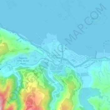
Name: Taganito topographic map, elevation, terrain.

Location: Taganito, Claver, Surigao del Norte, Caraga, 8410, Philippines (9.52153 125.80242 9.56153 125.84242)

Average elevation: 43 m

Minimum elevation: 0 m

Maximum elevation: 299 m

Gear up for your next adventure:

🎒Fully Waterproof Backpack - Total protection for photography gear and electronics
🧢Hiking Hat - Sun-protective and breathable hats for long treks
🥾Trail Hiking Boots - Supportive boots for rough trails
🔪Outdoor Multitool - Versatile tool for repairs and food prep in the wild
🧥Fleece Jacket - Warm and lightweight jacket for layering

As an Amazon Associate, this site earns from qualifying purchases at no extra cost to you.