Geolocate

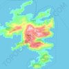
Archangelos topographic map

Click on the map to display elevation.

Archangelos

Archangelos is located about 30 kilometers south of the town of Rhodes on the island's east coast at an elevation of 160 meters. Its population according to the 2011 census was 5,384 making it the fifth largest town of the island (after the capital Rhodes, and the town of Trianta (Ialysos), Kremasti and Afantou. The town's name derives from Archangel Michael who is also considered its patron.

Wikipedia (CC-BY-SA 3.0)

About this map

Name: Archangelos topographic map, elevation, terrain.

Location: Archangelos, Municipality of Rhodes, Rhodes Regional Unit, South Aegean, Aegean, 851 02, Greece (36.17547 28.07738 36.25547 28.15738)

Average elevation: 128 m

Minimum elevation: -1 m

Maximum elevation: 538 m

Other topographic maps

Click on a map to view its topography, its elevation and its terrain.

Filerimos

Greece > South Aegean > Rhodes Regional Unit > Rhodes > Ialysos

Average elevation: 66 m

Symi

Greece > South Aegean > Rhodes Regional Unit > Symi

Average elevation: 81 m

Gear up for your next adventure:

🔪Outdoor Multitool - Versatile tool for repairs and food prep in the wild
🏕️Camping Hammock - Integrated protection for sleeping between trees
🥾Waterproof Hiking Boots - Boots keeping your feet dry in wet conditions
🧭Orienteering Kit - Tools for map reading and navigation in the wild
🦶Anti-Blister Balm - Prevents friction and hotspots during long ascents

As an Amazon Associate, this site earns from qualifying purchases at no extra cost to you.