Geolocate

Vallon topographic map

Click on the map to display elevation.

About this map

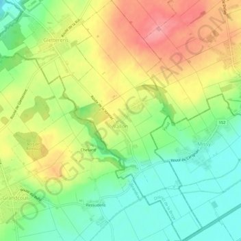
Name: Vallon topographic map, elevation, terrain.

Location: Vallon, District de la Broye, Fribourg, 1565, Switzerland (46.86539 6.93865 46.90123 6.96944)

Average elevation: 474 m

Minimum elevation: 428 m

Maximum elevation: 529 m

Gear up for your next adventure:

🥾Waterproof Hiking Boots - Boots keeping your feet dry in wet conditions
🥾Waterproof Hiking Boots - Essential footwear for rugged terrain and wet Canadian trails
🥘Camping Cookware Set - Compact nesting pots and pans for trail cooking
🧥Waterproof Hiking Jacket - Protect yourself from rain and wind while hiking
🧭GPS Tracker - Track your location in remote areas safely

As an Amazon Associate, this site earns from qualifying purchases at no extra cost to you.