Geolocate

Colon topographic map

Click on the map to display elevation.

About this map

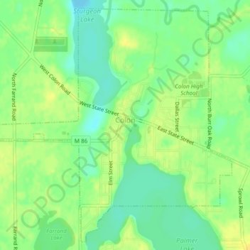
Name: Colon topographic map, elevation, terrain.

Location: Colon, Colon Township, Saint Joseph County, Michigan, 49040, United States (41.94471 -85.34657 41.97085 -85.30891)

Average elevation: 262 m

Minimum elevation: 250 m

Maximum elevation: 272 m

Other topographic maps

Click on a map to view its topography, its elevation and its terrain.

Nottawa

United States > Michigan > Saint Joseph County

Average elevation: 257 m

Gear up for your next adventure:

🧊Portable Cooler - Keep food and drinks cold during outdoor adventures
🥾All-Terrain Hiking Boots - Versatile boots for varied hiking conditions
🥾Trail Running Shoes - Lightweight and durable shoes for trail running
🧢Hiking Hat - Sun-protective and breathable hats for long treks
🥾Light Trekking Boots - Supportive boots for multi-day treks

As an Amazon Associate, this site earns from qualifying purchases at no extra cost to you.