Geolocate

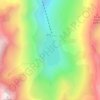
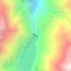
Mounicou topographic map

Click on the map to display elevation.

About this map

Name: Mounicou topographic map, elevation, terrain.

Location: Mounicou, Auzat, Foix, Ariège, Occitanie, France métropolitaine, 09220, France (42.68770 1.43012 42.72770 1.47012)

Average elevation: 1,600 m

Minimum elevation: 946 m

Maximum elevation: 2,465 m

Other topographic maps

Click on a map to view its topography, its elevation and its terrain.
Barrage du Pla de Soulcem

France > Occitanie > Ariège > Auzat

Average elevation: 1,941 m

Étang d'Izourt

France > Occitanie > Ariège > Auzat

Average elevation: 2,062 m

Étang de Montéstaure

France > Occitanie > Ariège > Auzat

Average elevation: 2,301 m

Étang Sourd

France > Occitanie > Ariège > Auzat

Average elevation: 1,945 m

Étang d'Alate

France > Occitanie > Ariège > Auzat

Average elevation: 1,737 m

Étang Fourcat

France > Occitanie > Ariège > Auzat

Average elevation: 2,507 m

Étang de Soulcem

France > Occitanie > Ariège > Auzat

Average elevation: 1,975 m

Gear up for your next adventure:

🧦Thermal Socks - Warm socks for winter hiking or camping
🧥Thermal Layer - Insulating layer for cold outdoor conditions
💧Filtered Water Bottle - Safe drinking water on the go
🥾Waterproof Trail Shoes - Shoes designed to handle wet terrain
🔦UV Flashlight - Detect minerals or specific insects in the dark

As an Amazon Associate, this site earns from qualifying purchases at no extra cost to you.