Geolocate

Culis topographic map

Click on the map to display elevation.

About this map

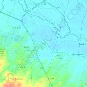
Name: Culis topographic map, elevation, terrain.

Location: Culis, Hermosa, Bataan, Central Luzon, 2111, Philippines (14.81885 120.46082 14.85885 120.50082)

Average elevation: 14 m

Minimum elevation: 4 m

Maximum elevation: 58 m

Gear up for your next adventure:

💧Reusable Water Bottle - Durable water bottles for hydration on trails
🥾Hiking Boots - Sturdy boots providing ankle support and traction on rugged trails
🧶550 Survival Paracord - Versatile utility cord for emergency repairs and rigging
🪑Insulated Seat Pad - Protect your seat from cold rocks and wet logs
🧢Outdoor Cap - Protective cap for sun and rain during hikes

As an Amazon Associate, this site earns from qualifying purchases at no extra cost to you.