
East Sikkim District topographic map
Interactive map
Click on the map to display elevation.
About this map
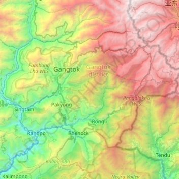
Name: East Sikkim District topographic map, elevation, terrain.
Average elevation: 2,107 m
Minimum elevation: 212 m
Maximum elevation: 5,191 m
Other topographic maps
Click on a map to view its topography, its elevation and its terrain.
Rangpo
Inde > Sikkim > Pakyong subdivision
Rangpo, Pakyong subdivision, Pakyong District, Sikkim, 737132, Inde
Average elevation: 731 m