Geolocate

Galang topographic map

Click on the map to display elevation.

About this map

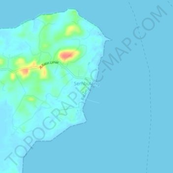
Name: Galang topographic map, elevation, terrain.

Location: Galang, Batam City, Riau Islands, Sumatra, Indonesia (0.82818 104.24023 0.86818 104.28023)

Average elevation: 4 m

Minimum elevation: -1 m

Maximum elevation: 60 m

Other topographic maps

Click on a map to view its topography, its elevation and its terrain.

Pulau Galang

Indonesia > Riau Islands > Batam City

Average elevation: 9 m

Gear up for your next adventure:

🧴Outdoor Sunscreen - High SPF protection for high-altitude UV exposure
🪜Heavy Duty Carabiners - Multi-use clips for securing gear to your backpack
🦟Insect Repellent - Keep mosquitoes and black flies away in wooded areas
💧Hydration Bladder - Hands-free hydration solution for long treks
🧦Thermal Socks - Warm socks for winter hiking or camping

As an Amazon Associate, this site earns from qualifying purchases at no extra cost to you.