
Blauwe Kei topographic map
Interactive map
Click on the map to display elevation.
About this map
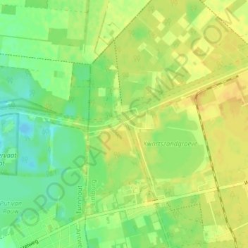
Name: Blauwe Kei topographic map, elevation, terrain.
Location: Blauwe Kei, Lommel, Maaseik, Limburg, Vlaanderen, 3920, België (51.21757 5.20485 51.25757 5.24485)
Average elevation: 39 m
Minimum elevation: 26 m
Maximum elevation: 49 m
Blauwe Kei is een plaats in de Belgische stad Lommel in de provincie Limburg. Blauwe Kei is ontstaan na het graven van het kanaal Bocholt-Herentals, ter hoogte van de eerste sluis, en valt onder het gehucht Lommel-Werkplaatsen (Lommel-Fabriek). Iets verder richting Antwerpen is tevens de aftakking van Kanaal naar Beverlo dat eindigt in Leopoldsburg.
Other topographic maps
Click on a map to view its topography, its elevation and its terrain.
Gelderhorsten
België > Limburg > Maaseik > Lommel
Gelderhorsten, Lommel, Maaseik, Limburg, Vlaanderen, 3920, België
Average elevation: 45 m