
Grand Cayman topographic map
Click on the map to display elevation.
Grand Cayman
Grand Cayman encompasses 76% of the territory's entire land mass. The island is approximately 22 miles (35 km) long with its widest point being 8 miles (13 km) wide. The elevation ranges from sea level at the beaches to 60 feet (18 m) above sea level on the North Side's Mastic Trail. Unlike many other Caribbean islands, Grand Cayman is for the most part, flat. This allows for more space to build as the island’s population grows.
About this map
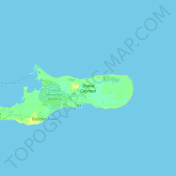
Name: Grand Cayman topographic map, elevation, terrain.
Location: Grand Cayman, Cayman Islands (19.26290 -81.42021 19.39685 -81.08468)
Average elevation: 1 m
Minimum elevation: 0 m
Maximum elevation: 16 m
Other topographic maps
Click on a map to view its topography, its elevation and its terrain.